


GeoInfoMex

 |
Latest Version | 3.1 |
 |
Update | Mar,17/2025 |
 |
Developer | Servicio Geológico Mexicano |
 |
OS | Android 5.1 or later |
 |
Category | Tools |
 |
Size | 2.95M |
| Tags: | Tools |
-
Latest Version
3.1
-
Update
Mar,17/2025
-
Developer
Servicio Geológico Mexicano
-
OS
Android 5.1 or later
-
Category
Tools
-
Size
2.95M


 Download(3.1)
Unlock Mexico's Geological Secrets with GeoInfoMex!
GeoInfoMex, the premier geological consultation app, puts the power of geoscience at your fingertips. Explore Mexico's hidden depths with access to a wealth of geological, mining, and geophysical data.
This indispensable resource provides:
-
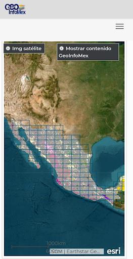
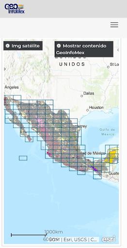
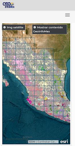
Comprehensive Geological Data: Access detailed maps and information encompassing geological-mining activities, geophysical surveys, and geochemical analyses across the Mexican Republic.
-
Mining and Rock Information: Discover details on mines, beneficiation plants, and significant rock formations. Locate key sites and understand their characteristics.
-
Land Ownership Insights: Explore land ownership details from the National Agrarian Registry, gaining valuable insights into agrarian nuclei (ejidos) and land boundaries.
-
Protected Natural Area Exploration: Discover Mexico's diverse natural landscapes and their conservation status, managed by CONANP. Ideal for eco-tourism enthusiasts and conservationists alike.
-
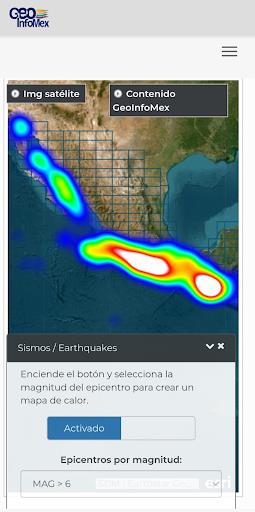
Real-time Earthquake Monitoring: Stay informed about seismic activity with real-time earthquake data from reputable sources like SSN and IG-UNAM.
-
Hydrological Data Access: Access hydrological data from Cencas, including water resources, river basins, and water quality information.
In short: GeoInfoMex is the ultimate tool for geoscientists, researchers, environmentalists, and anyone fascinated by Mexico's geological wonders. Download now and embark on an unparalleled geological adventure!