


MAPinr - KML/KMZ/OFFLINE/GIS

 |
Latest Version | 4.1.2 |
 |
Update | Dec,30/2024 |
 |
Developer | Xylem Technologies |
 |
OS | Android 6.0+ |
 |
Category | Travel & Local |
 |
Size | 76.3 MB |
 |
Google PlayStore |  |
| Tags: | Travel & Local |
-
Latest Version
4.1.2
-
Update
Dec,30/2024
-
Developer
Xylem Technologies
-
OS
Android 6.0+
-
Category
Travel & Local
-
Size
76.3 MB
-
Google PlayStore


 Download(4.1.2)
MAPinr: Your All-in-One KML/KMZ/GPX Manager for Android
MAPinr is a free, ad-free Android app designed for effortless management of your KML, KMZ, and GPX files. Ideal for professionals and outdoor enthusiasts alike (hiking, cycling, etc.), MAPinr offers comprehensive features for creating, editing, and sharing geographic data. Due to the rapid evolution of Android versions, we appreciate your understanding as a non-profit project striving to maintain a secure, privacy-respecting, and accessible application. Downloads for older Android versions (pre-Android 14) are available on our website, as they're no longer supported by the Google Play Store.
Key Features:
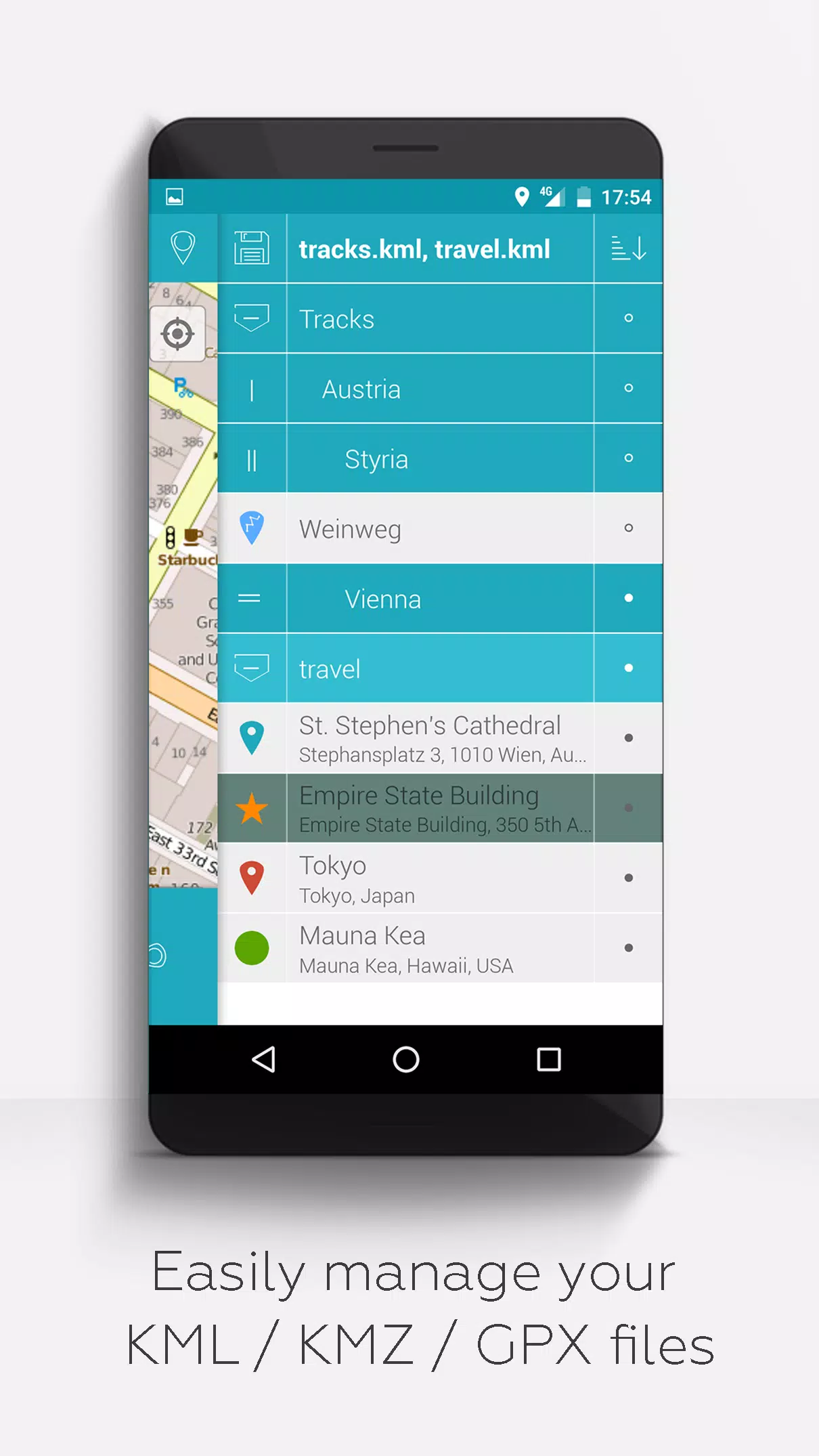
- Effortless File Management: Organize your files using a hierarchical folder structure. Create, load, edit, save, import, export, and share KML/KMZ/GPX data with ease.
- Versatile Mapping: Display your waypoints, lines, tracks, and polygons on various map types (Maps, Satellite, Hybrid, OpenStreetMap, Opentopomap, Opencyclemap).
- Enhanced Visualization: Add pictures to waypoints to create photomaps, and customize the colors of your data for improved clarity.
- Sharing and Collaboration: Share waypoint coordinates with others and utilize location-sharing features.
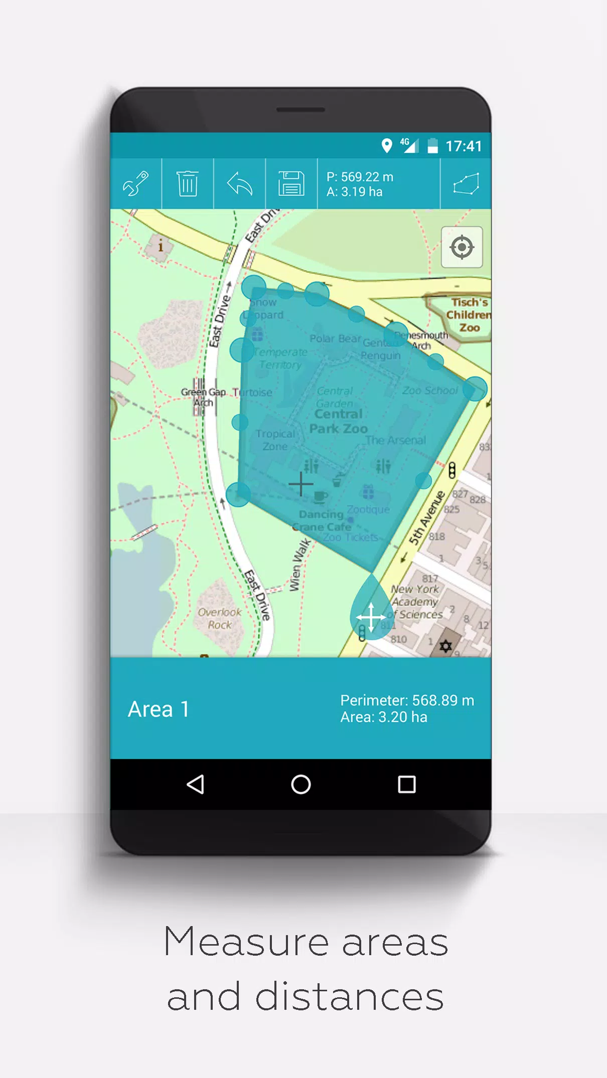
- Powerful Tools: Measure distances and areas, merge KML/KMZ files, and integrate with cloud services. Search by name, address, or coordinates.
- Multilingual Support: Currently available in English, Spanish, Lithuanian, and Polish.
- Open and Secure: Unlike some competitors, MAPinr respects your privacy and will never sell your data.
Extended Features (Free with donations or LinkedIn endorsement; activate in Settings):
- Offline Maps: Download OpenStreetMap maps for offline use.
- GPX Viewing: View GPX files (display only).
- WMS Support: Display custom map data using Web Map Services (WMS).
- Customization: Create custom metadata and upload your own icons.
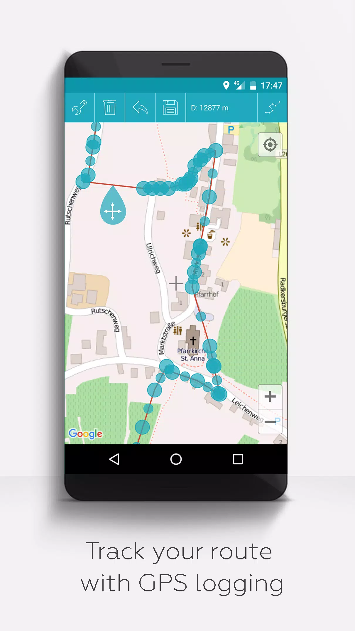
- GPS Tracking: Record your GPS tracks.
We value your feedback! Share your suggestions and bug reports at [email protected]. Your patience and understanding are appreciated as we work within our limited resources. Donations are welcome to support our non-profit mission.
-
 MapNerdGreat app for managing my KML/KMZ/GPX files. It's simple and efficient.